 |
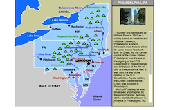
Mid-Atlantic States Interactive Map
This interactive map allows students to learn all about the states, cities, landforms, landmarks, and places of interest in the Mid-Atlantic states by simply clicking on the points of the map. |
|
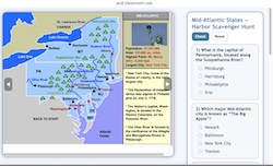 |
Mid-Atlantic States Interactive Scavenger Hunt
This interactive scavenger hunt helps students explore the Mid-Atlantic States by combining an engaging clickable map with a 10-question quiz on key landmarks, cities, and geography. Learners can check their answers online or print the scavenger hunt and answer key for offline review and classroom use. |
|
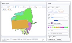 |
Make Your Own Mid-Atlantic Map
Use our colorful Super Maptivation program to make your own customized Mid-Atlantic map. You can fill in the states with colors, add labels, landscapes, a key, and much mxqore! |
|
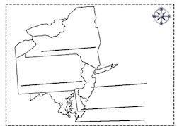 |
Mid-Atlantic Printable Label-me Quiz
This is a printable activity that requires students to identify the Mid-Atlantic states. |
|
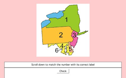 |
Mid-Atlantic Label-me Quiz Online
This is an online quiz that requires students to identify the Mid-Atlantic states.
|
|
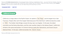 |
Mid-Atlantic Correct-me Passage
In this activity, you’ll read a short paragraph about a U.S. region that contains 10 hidden factual errors. Click on any word or phrase you think is wrong, choose the correct answer from four options, and keep fixing until the entire paragraph is accurate! |
|
| |