| The Midwestern states, often called “America’s Heartland,” are known for their vast farmlands, major rivers, and strong agricultural and industrial traditions. This region plays a key role in the nation’s economy, culture, and history, blending rural charm with vibrant cities like Chicago and Minneapolis. |
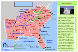 |
Southern States Interactive Map
This interactive map allows students to learn all about the states, cities, landforms, landmarks, and places of interest in the American South by simply clicking on the points of the map. |
|
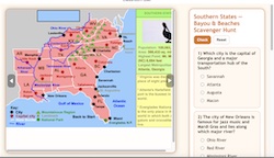 |
Southern States Interactive Scavenger Hunt
This interactive scavenger hunt explores the geography, landmarks, and culture of the Southern United States through an engaging multiple-choice quiz. Students can navigate an interactive map of the South while testing their knowledge of cities, rivers, mountains, and coastal regions from Louisiana to Virginia. |
|
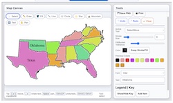 |
Make Your Own Southern States Map
Use our colorful Super Maptivation program to make your own customized Southern states map. You can fill in the states with colors, add labels, landscapes, a key, and much mxqore! |
|
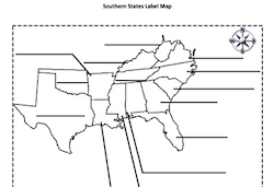 |
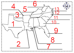
Southern States Label-me Quiz Printable
This is a printable activity that requires students to identify the southern states. |
|
 |
Southern States Label-me Quiz Online
This is an online quiz that requires students to identify the southern states.
|
|
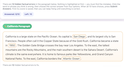 |
Southern States Correct-me Passage
In this activity, you’ll read a short paragraph about a U.S. region that contains 10 hidden factual errors. Click on any word or phrase you think is wrong, choose the correct answer from four options, and keep fixing until the entire paragraph is accurate! |
|
| |
|