United States Landforms
United States Landforms |
United States Landforms
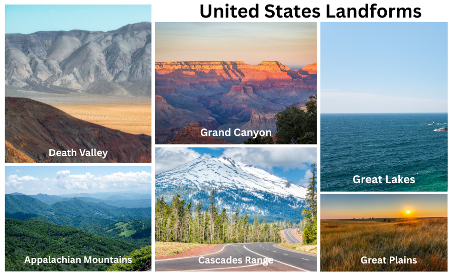
The United States is home to an incredible variety of landforms shaped by millions of years of geological activity. From towering mountains to flat plains, each region tells a story of natural forces at work. The Rocky Mountains stretch across the western part of the country, offering rugged peaks and alpine valleys. To the east, the Appalachian Mountains are older and more weathered, covered in dense forests and rolling hills.
Between these ranges lies the Great Plains, a vast area of grasslands that supports agriculture and wildlife. The Mississippi River cuts through the heart of the nation, draining waters from more than 30 states into the Gulf of Mexico. To the southwest, deserts like the Mojave and Sonoran feature unique rock formations and dry basins shaped by erosion and wind.
In the north, the Great Lakes form the largest group of freshwater lakes on Earth, while the coastal regions vary from sandy Atlantic beaches to rocky Pacific cliffs. Alaska’s glaciers and volcanoes reveal Earth’s dynamic power, and Hawaii’s volcanic islands rise dramatically from the ocean. Together, these landforms create a landscape of stunning diversity that defines the geography and natural beauty of the United States.
|
Fast Facts and Interesting Facts |
| 🌍 Region |
North America (United States) |
Interesting Facts |
| 📏 Total Area |
About 3.8 million square miles |
- ⛰️ The Rocky Mountains stretch over 3,000 miles from Canada to New Mexico, forming the spine of western North America.
- 🏞️ The Appalachian Mountains are among the oldest mountain ranges in the world, formed over 480 million years ago.
- 🌾 The Great Plains are one of the largest flatland areas on Earth, covering parts of ten U.S. states and famous for rich soil and farming.
- 🔥 Death Valley, located in California, is the hottest and driest place in North America, with summer temperatures often above 120°F (49°C).
- 🕳️ The Grand Canyon in Arizona is over a mile deep and was carved by the Colorado River over millions of years.
- 💧 The Great Lakes—Superior, Michigan, Huron, Erie, and Ontario—form the largest group of freshwater lakes on Earth by total area.
- 🚤 The Mississippi River is the second-longest river in North America and drains 31 U.S. states.
- 🏔️ The Sierra Nevada Range is home to both the highest and lowest points in the contiguous U.S.—Mount Whitney and Death Valley.
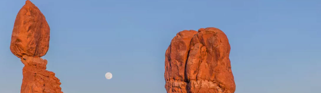
- 🌈 The Colorado Plateau is famous for colorful rock formations and national parks like Zion, Bryce Canyon, and Arches.
- 🌋 The Alaskan terrain includes more than 100 volcanoes and some of the largest glaciers in North America.
|
| ⛰️ Major Mountain Ranges |
Rocky Mountains, Appalachian Mountains, Sierra Nevada, Cascades |
| 🌾 Major Plains |
Great Plains, Coastal Plains |
| 🪨 Major Plateaus |
Colorado Plateau, Columbia Plateau |
| 🏜️ Major Deserts |
Mojave Desert, Sonoran Desert, Great Basin Desert |
| 🌊 Major Rivers |
Mississippi, Missouri, Colorado, Rio Grande, Columbia |
| 🏔️ Highest Point |
Denali (Mount McKinley), Alaska – 20,310 ft (6,190 m) |
| 🏝️ Lowest Point |
Death Valley, California – 282 ft (86 m) below sea level |
| 🌅 Coastal Features |
Atlantic and Pacific coastlines, Gulf of Mexico, Great Lakes |
|
|
| |
Our Content |
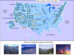 |
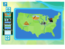
United States Landmarks Interactive Map and Map Activities
The United States Landforms Interactive Map is an engaging, clickable learning tool that helps students explore the country’s most famous natural features. The map highlights major landforms such as mountain ranges, rivers, plateaus, deserts, plains, lakes, and valleys. When users hover over or click on each labeled region, a popup or information box appears with a brief description, interesting facts, and historical or geographical context about that feature. This section also includes an interactive scavenger hunt! |
|
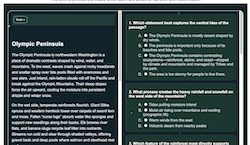 |
United States Landforms Literacy and Comprehension Exercises
This section features a variety of literacy and reading comprehension activities, including engaging passages with question sets, cloze reading exercises, and lessons on text elements and structure. These resources are generally appropriate for students in grades 4–8, and many include adjustable Lexile levels and customizable question sets. |
|
 |
United States Landmarks Online Games and Activities
This section features a variety of exciting landform-themed activities, including Landforms Central, a printable and online word search, a Landforms Paralaugh game, a Correct-Me passage, and Postcards Across America. |
|
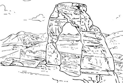 |
United States Landforms Printables and Coloring Activities
This section features fun and educational landforms-themed coloring activities and printables. |
|