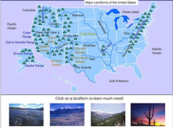
This interactive map allows students to click and learn about any of 26 U.S.A. landforms and waterways such as the Rocky Mountains, Sierra Nevada Range, Mississippi River, Rio Grande, Appalachian Mountains, and many more.
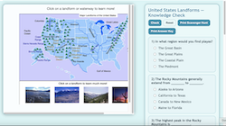
This interactive scavenger hunt explores major landforms across the United States through an engaging quiz format. Students view an interactive map on the left while answering questions on the right to test their geographical knowledge. Printable scavenger hunt and answer key options make it ideal for both digital and classroom use.
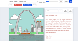
The Digital Postcard Creator is an interactive web tool that lets students color digital images of American landmarks, national parks, and city skylines while writing their own postcard messages beside them. It encourages creativity, research, and writing skills by combining art, geography, and technology into one engaging activity.