Explorer Maps - Download Lesson |
||
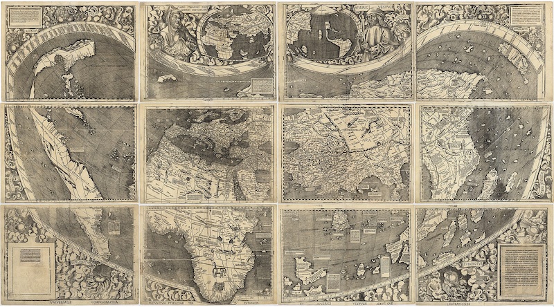
Waldseemüller World Map (1507) |
||
How Early Explorer Maps Were MadeLong before GPS and satellites, explorers depended on hand-drawn maps to travel across oceans and discover new lands. These early maps were created by cartographers, who gathered information from sailors, journals, and older maps. Because they often relied on secondhand reports, early maps sometimes mixed accurate geography with guesses or legends. Common Features of Old MapsMany early sea maps, called charts, focused on coastlines. They showed harbors, islands, winds, and dangerous rocks. A key feature was the compass rose, a symbol that showed directions. Thin lines called rhumb lines stretched across the map, helping sailors follow a steady compass direction during long voyages.
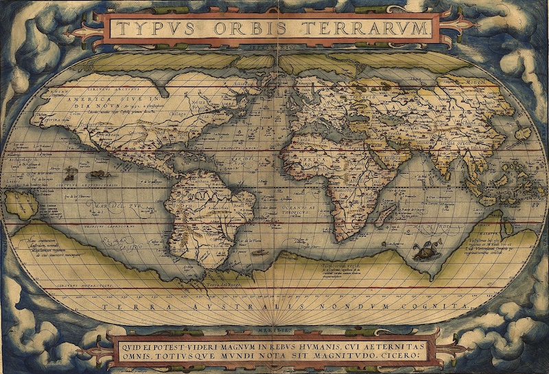
Abraham Ortelius (1570)
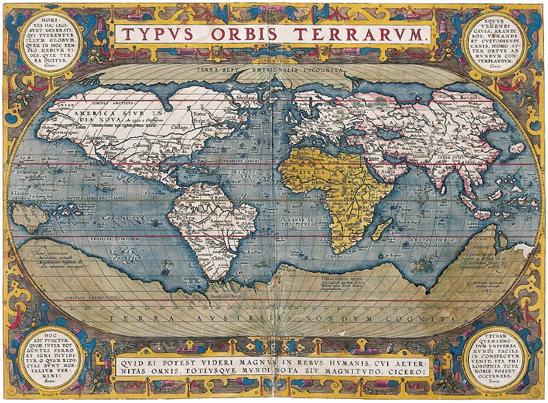
Abraham Ortelius (1587) Old maps were also decorated with artwork. Ships sailed across the page, banners labeled regions, and sometimes sea monsters warned of unknown waters. These artistic touches made the maps beautiful but also showed how little was known about the world. How Maps Improved Over TimeAs navigation tools improved, so did the maps. Explorers learned to measure their location using the stars, latitude, and longitude. Mapmakers developed new projections—ways to draw the round Earth on flat paper—making maps more accurate. The Mercator projection, for example, turned complex curved routes into straight lines, helping sailors plan long sea journeys. Example Explorer Map: Waldseemüller World Map (1507) - See AboveThis famous map is the first known map to label the Western Hemisphere as “America.” It was printed from many woodcut blocks and designed to form a giant wall map. Europe, Africa, and Asia appear in familiar medieval shapes, while the Americas stretch along the left side as long, narrow continents. Notes, labels, and decorative writing fill the oceans, showing how explorers were beginning to piece together a more realistic view of the world. Discussion Questions
Glossary
Early MapsHundreds of years ago, explorers used hand-drawn maps. Cartographers listened to sailors’ stories and tried to draw what the world looked like, even if they did not know everything. Map FeaturesOld maps showed coasts, islands, and harbors. A compass rose showed directions, and rhumb lines helped sailors follow a straight course. Many maps also had drawings of ships and sea creatures. Better Maps Over TimeAs explorers learned more, maps improved. Latitude, longitude, and new map projections helped people make more accurate drawings of the world. Example Map
You can see an early world map here:
|
||
|
||
| Explorer Maps Activities | ||
|